山麓+2度曇り モイワ800m+2.0度北西3.8m アンヌプリ1100m+0.1度西北西4.3m ビレッジ1000m+1.1度西北西1.9m ヒラフ花園1000m+0.7度北2.1m 花園800m+3.5度北1.3m 弁慶岬風よわく神威岬南南西8m気圧1016hPa波高不明、
海上、山ともにおだやか、観測とデータ評価から標高1000m鉱山の沢側壁、アンヌプリ大沢雪庇面の全層雪崩リスクは引き続き高い。谷底の滑走は控えるべき。雪は悪くない。ゲート開閉は未定、パトロールの指示に従うこと。この情報はコース外の雪崩事故防止を目的に出されている。しかし雪崩事故は減ったがそれ以外の事故はなかなか減らない。今シーズンも迷子や衝突、疾病による死亡事故が続いた。客が増える以上、それはやむを得ないことなのかもしれない。私たちはその日に予想されるリスクを呼び掛け、事故の可能性を少しでも減らす努力を続けている。
唐突だが私たちはそろそろ弱層の呪縛から解き放たれるべきではないのか。ヨーロッパで生まれ、日本に広まった弱層理論は果たして日本の雪崩事故防止に役だっただろうか。この40年、雪崩事故は起こり続けている。そして事故に遭う人の多くが雪崩の知識を得た人たちだ。私は何かが間違っていると思う。事故後に原因がわかっても死者は還らない。少なくとも主観に頼るピットチェックやショベルテストが事故防止に役立っているとはどうしても思えない。コシモザラメが本当に雪崩の原因だろうか。人は知識を求める。だから雪崩講習会は今も盛況だ。事故を防ぐための役に立つ教育が今こそ求められている。研究と教育を混同してはならない。以上はニセコ雪崩調査所の意見だ。ニセコ雪崩情報を終える。
Mountain base: +2°C, cloudy. Moiwa 800m: +2.0°C, NW 3.8m/s. Annupuri 1100m: +0.1°C, WNW 4.3m/s. Village 1000m: +1.1°C, WNW 1.9m/s. Hirafu Hanazono 1000m: +0.7°C, N 2.1m/s. Hanazono 800m: +3.5°C, N 1.3m/s. Sea of Japan Benkei Cape: light winds. Kamui Cape: SSW 8m/s, 1016hPa, wave height unknown.
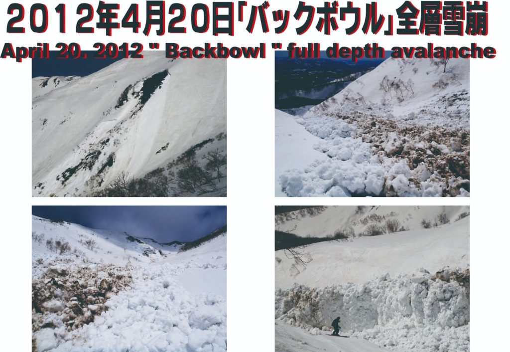
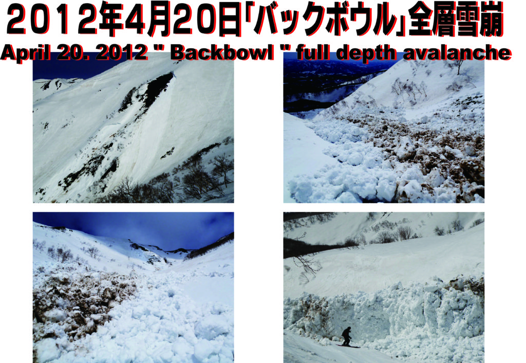
Both the sea and the mountain range are calm. Based on observations and data evaluation, the risk of full-depth avalanches remains high at the 1000m Kozan-no-sawa (Backbowl) sidewalls and the Annupuri Osawa cornice face. Skiing in the gully bottoms should be avoided. The snow is not bad. Gate status is TBD; follow the instructions of the ski patrol. This information is issued with the goal of preventing out-of-bounds avalanche accidents. However, while avalanche accidents have decreased, other incidents show no sign of waning. This season, we have continued to see fatalities due to people getting lost, collisions, and medical emergencies. With the increase in visitors, perhaps this is unavoidable. We continue our efforts to communicate the expected risks of the day and reduce the possibility of accidents as much as possible.
At the risk of being blunt, perhaps it is time for a radical departure from the status quo. Should we not finally free ourselves from the obsession with “weak layers”? Has the weak-layer theory, born in Europe and spread through Japan, truly served to prevent avalanche accidents here? For 40 years, avalanche accidents have continued unabated, and many victims are those who had already acquired avalanche knowledge. I believe something is fundamentally wrong. Identifying the cause after a tragedy cannot restore the lost lives. Subjective pit checks and shovel tests simply do not seem to be effective tools for accident prevention. Are facets and depth hoar the only justification for avalanches? People seek knowledge, which is why avalanche seminars remain popular. What is needed now is practical, effective education—the kind that actually prevents accidents. We must stop confusing academic research with safety education. These are the views of the Niseko Avalanche Institute.
With that, we conclude the Niseko Avalanche Information for the season.