山麓-7度降雪なく晴れ モイワ800m-7.5度北東3.9m降雪なく視界良 アンヌプリ1100m-9.8度北北東4.8m ビレッジ1000m-8.5度北北東6.4m ヒラフ花園1000m-9.3度北5.8m 花園800m-6.7度北西1.6m 日本海弁慶岬西北西5m 神威岬東北東2m気圧1027hPa波高不明、
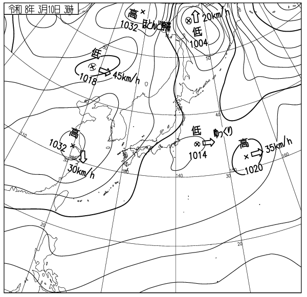
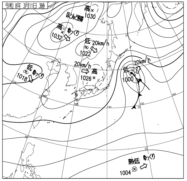
高圧帯の中で気圧の傾きなく北から強い寒気が流入、観測と各データの評価から全層雪崩の発生はなく積雪は安定。全体の雪崩リスクは低い。天気も良いので各山頂ゲートは開けられる。モイワ6番は午前中開けられる見込み、パトロールの指示に従うこと。標高1000m以上の開けた急斜面では表面クラストが割れて浅い表層雪崩が起こる可能性がある。魔法の絨毯と呼ばれるこれらの雪崩は滑走刺激で起こり速度が速く危険。バックボウル側壁では過去にこのような雪崩で一人が亡くなっている。山では一人ずつ滑ること。午後には雪が緩み全層雪崩の危険が高まる。特に西尾根五色側では注意。過去に道道まで達する雪崩が起こっている。斜面下や谷底にいてはならない。モイワボウル、見返りボウルでも同様に注意。今日は東日本大震災の日。2011年3月11日、この日東北沿岸を襲った地震と津波で1万7000人以上の尊い命が奪われた。この記憶を風化させてはならない。良い一日を。
Mountain base: -7°C, no snowfall, clear. Moiwa 800m: -7.5°C, NE 3.9m/s, no snowfall, good visibility. Annupuri 1100m: -9.8°C, NNE 4.8m/s. Village 1000m: -8.5°C, NNE 6.4m/s. Hirafu Hanazono 1000m: -9.3°C, N 5.8m/s. Hanazono 800m: -6.7°C, NW 1.6m/s. Sea of Japan Benkei Cape: WNW 5m/s. Kamui Cape: ENE 2m/s, 1027hPa, wave height unknown.
Under a high-pressure system with no pressure gradient, strong cold air is flowing in from the north. Based on observations and data evaluation, no full-depth avalanches have occurred and the snowpack is stable. The overall avalanche risk is low. With the good weather, all summit gates will open. Moiwa Gate 6 is expected to open during the morning; follow the instructions of the ski patrol. On open steep slopes above 1000m, the surface crust may break, potentially causing shallow surface avalanches. These slides, known as “magic carpet” avalanches, are triggered by riding stimulation and are dangerous due to their high speed. In the past, one person lost their life in such an avalanche in the Backbowl sidewalls. Ride one by one in the out of bounds areas. In the afternoon, the snow will soften and the risk of full-depth avalanches will increase. Use particular caution on the west ridge toward the Goshiki side. In the past, avalanches there have reached the prefectural road. Do not stay at the bottom of the slopes or gullies. Use similar caution in Moiwa Bowl and Mikaeri Bowl. Today is the anniversary of the Great East Japan Earthquake. On March 11, 2011, more than 17,000 precious lives were taken by the earthquake and tsunami that struck the Tohoku coast. We must never let this memory fade. Have a great day.
出典 Source:気象庁 JMA website (www.jma.go.jp/bosai/weather_map/)