• ニセコ雪崩情報第5号 Niseko Avalanche Info No.5

    山麓-1度西南西2m降雪12時間10cm24時間20cm モイワ見返り-7度西北西3.8m視界不良 海上弁慶岬北西16m 神威岬西12m気圧1018hPa波高2.1m 花園800m-6.2度北北西6.3m積雪データなし


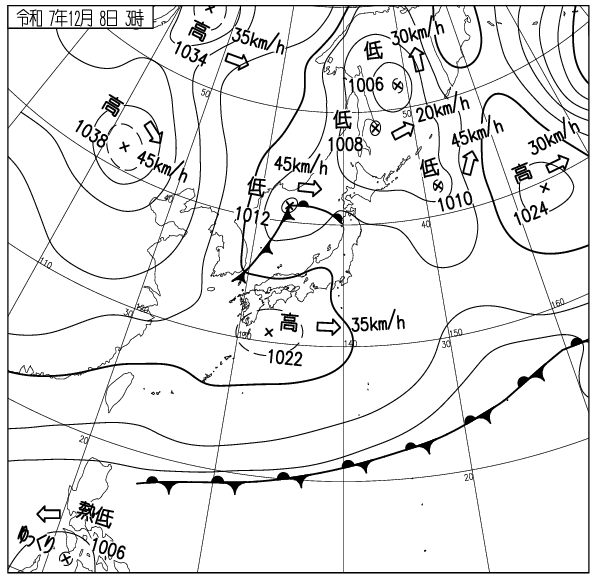
    夜半東北地方地震震度7津波最大40cm 気圧配置冬型

    標高800m以上で20m/s以下の風雪、量は少ないが稜線風下側に雪庇ふきだまりが発達、雪は昨日の低気圧降雪20cmとともに雪板化(スラブ化)しており開けた急斜面で浅い面発生雪崩が起こりやすい。

    ゲレンデは薄く新雪に覆われているが下部コース以外は滑走不適、今怪我をすればシーズンを棒に振る。気象推移、凍傷に注意、良い一日を。


    Mountain base: -1℃, WSW2m/s, 10cm snowfall in the last 12hrs, 20cm in 24hrs. Moiwa Mikaeri 800m: -7℃, WNW3.8m/s, bad visibility. Hanazono 800m: -6.2℃, NNW6.3m/s. Coastal weather: Benkei cape NW16m/s, Kamui cape W12m/s, 1018hPa, 2.1m waves.

    Earthquake in Tohoku area at midnight: Intensity 7, Tsunami Peak 40cm. Winter-type pressure pattern.


    Snowstorms with winds below 20m/s over 800m elevation. Though snowfall amounts are low, snowdrifts have developed on the leeward side of ridgelines. Snow has formed a slab layer with yesterday’s 20cm of low-pressure snowfall, making shallow surface avalanches likely on open steep slopes.


    Ski slopes are covered with a thin layer of fresh snow, but skiing is unsuitable except on lower courses. Getting injured now could ruin your entire season. Monitor weather changes and beware of frostbite. Have a good day.

    出典 Source:気象庁 JMA website (www.jma.go.jp/bosai/weather_map/)

  • ニセコ雪崩情報第4号 Niseko Avalanche Info No.4

    山麓6時+2度積雪30cm  モイワ見返り800m-7度南東1.5m降雪視界不良 花園800m-1.4度北3.0m夜半0時北東23m/s突風 日本海弁慶岬北北西5m 神威岬南西7m気圧1012hPa波高1.1m、

    未明まで降雪なし、午前6時から低気圧前面降雪、午後には前線通過で山は荒れ模様の見込み。雪は依然少なく圧雪されたコース以外は滑走不能、待つしかない。

    寒暖差が大きいため地表付近のシモザラメ化が進んでいる。この層は初冬のニセコに稀に見られ、全層雪崩の原因となる。コース法面や笹地表の急斜面では注意。

    事故が最も多い面発生表層雪崩は吹雪など悪天候時に起こりやすい。風雪時に風下側のふきだまり斜面を滑ってはならない。スラブが弱線破断して雪崩を起こす。良い一日を。

    Mountain base 6am: +2℃, 30cm snowpack. Moiwa Mikaeri 800m: -7℃, SE1.5m/s, snowing and bad visibility. Hanazono 800m: -1.4℃, N3.0m/s (NE23m/s gusts at midnight). Coastal weather: Benkei cape NNW5m/s, Kamui cape SW7m/s, 1012hPa, 1.1m waves. 

    No snowfall until predawn, but started to fall around 6am as the next Low Pressure approaches. The Cold Front will pass in the afternoon and the weather is forecasted to deteriorate. The snowpack remains shallow and the slopes are not suitable for skiing except the groomed runs. Patience is required. 

    Depth hoar is developing with the recent large temperature swing. This is quite unusual for early Winter in Niseko and can potentially be a trigger layer for glide avalanches. Caution is required in steep slopes on the course-sides and/or with bamboo-grass. Surface slab avalanches, which are the cause of most accidents, mostly occur during snowstorms or other bad weather conditions. Leeward slopes with heavy snowdrift deposits should be avoided during strong winds and snowfalls. Weak bonding within the newly formed slabs can easily fail and trigger a slide. Have a nice day. 

    出典 Source:気象庁 Japan Meteorological Agency (www.jma.go.jp/bosai/weather_map/)

  • ニセコ雪崩情報第3号 Niseko Avalanche Info No.3

    モイワ山麓風よわく+4度降雪なし曇り視程800m以下 日本海弁慶岬西北西8m 神威岬南西16m気圧1012hPa波高1.5m 花園+0度北3.2m濃霧視界不良降雪わずか 見返り800m-3度南南東0.6m降雪わずか濃霧視界不良、

    日本海を暖気が北上、標高1000m以下はプラス気温と濃霧、1000m以上は南西の風がやや強い。夜半の弱い降雪が雪面の凹凸部に浅く堆積、観測から雪崩リスクは低いがコース法面、崖斜面では浅い雪崩に注意。光線が弱く斜面の凹凸が見づらい。暴走転倒衝突に注意。今怪我をすればシーズンを棒に振る。ゲレンデは混んでいる。他者への配慮を。雪はそのうちに降る。良い一日を。

    Mountain base: light wind, +4℃, no new snowfall, overcast, visibility less than 800m. Coastal weather: Benkei cape WNW8m/s, Kamui cape SW16m/s, 1012hPa, 1.5m waves. Hanazono: 0℃, N3.2m/s, thick fog, poor visibility and light dusting. Mikaeri 800m: -3℃, SSE0.6m/s, light dusting, thick fog and bad visibility.

    Warm air is flowing north from the Sea of Japan. The temperature is above freezing up to 1000m elevation. Thick fog is lying up high. Moderate SW wind is blowing above 1000m. A little bit of snow fell overnight and shallowly filled in the gap of the surface. Avalanche risk is low, however still to be considered on the steep course-side cut slopes and cliffbands. The light is weak and the terrain undulations are hard to see. Beware of overspeeding, falls and collisions. One injury now can ruin your season. The slopes are crowded, please mind of others. The snow will eventually come. Have a nice day.

    出典:気象庁HP (www.jma.go.jp/bosai/weather_map/)

  • ニセコ雪崩情報第2号 Niseko Avalanche Info No.2

    山麓+2度降雪なく曇り積雪30cm 海上弁慶岬西北西14m 神威岬南西17m ニセコ花園1000m南南東12.3m気温-3.6度 12月6日層を記録。

    上空の風は強いが雪は期待したほど入っていない。次の低気圧待ち。標高1000m以上は風が強く場所により雪庇ふきだまりが発達、

    雪庇は崩壊しやすく稜線直下では40cm以下の浅い面発生表層雪崩が起こりやすい。 

    ゲレンデの地形変化に注意、光がなく凹凸が見えづらい。暴走衝突に注意。今怪我をすればシーズンを棒に振る。良い一日を。

    Mountain base +2℃, cloudy with no new snowfall, snowpack 30cm. Coastal weather: Benkei cape WNW14m/s, Kamui cape SW17m/s. Niseko Hanazono 1000m: SSE12.3m/s, -3.6℃. Dec 6th layer recorded. 

    The upper sky wind is blowing strong, however it hasn’t brought much snow as anticipated. We’ll have to wait for the next Low-pressure to come. The wind speed remains high above 1000m elevation, developing cornices and snowdrifts in some areas. These cornices are highly likely to break. Surface slab avalanches of up to 40cm thickness are to be expected in leeward slopes just under ridgelines. 

    Beware of the groomers’ terrain undulation. The light is flat and the unevenness is hard to see. Be careful not to overspeed and crash. One injury now can ruin your whole season. Have a nice day.

  • ニセコ雪崩情報第1号 Niseko Avalanche Info No.1

    山麓6時 -7度 降雪12時間20cm 北西5m 弱い風雪。日本海弁慶岬北北西17m神威岬西南西14m1005hPa波高1.8m。

    西高東低冬型の気圧配置で寒気流入、標高800m以上は10m/sを越える西寄りの吹雪、雪庇ふきだまりが発達、標高900m以上の南斜面では、解けずに残った地表上の15cmがシモザラメ化している。笹の30度斜面では急激な積雪増で雪崩れやすくなるので注意。真冬でも全層雪崩は起こる。雪はまだ足りない。今無理をすればシーズンを棒にふる。知識技術を過信せず常に用心を。

    全ての観測測器が稼働するまでしばらくかかる。情報は不定期に出される。良いシーズンを。

    Mountain base 6am: -7℃, 12h snowfall 20cm, NW5m/s, light snow and wind. Coastal data: Benkei cape NNW17m/s, Kamui cape WSW14m/s, 1005hPa, 1.8m waves. 

    Wintery pressure distribution with a Low in the East and High in the West is making cold air flowing into Japan. Stormy weather with Northwesterly 10+m/s wind above 800m elevation. Snowdrifts are developing rapidly. The old snow that persisted in south facing slopes above 900m are forming a 15cm layer of granular snow (depth hoar) on top of the ground. Avalanches are likely to occur in 30degree slopes with bamboo-grass with the rapid growth of new snowpack. Glide avalanches can occur even in the heart of Winter. 

    The snowpack is still very shallow, don’t push it too hard and waste your season. Stay vigilant and do not overestimate your knowledge and skill. 

    It will take some more time to have all our observation instruments running. The report will be issued irregularly for some time. Have a great season. 

  • ニセコ雪崩情報第110号 Niseko Avalanche Info No.110

    4月1日からのヒラフスキー場営業休止に伴い、ヒラフ3番ゲートからの山頂登頂はできません。山頂へはアンヌプリ2番ゲートから登ってください。山頂からヒラフ側への滑走は、ヒラフトップリフト周辺での重機を使った作業中のため、危険です。絶対にヒラフ側へは滑り込まないようにお願いします。ビレッジのトップリフトを利用されるみなさんも、山頂へはアンヌプリ2番ゲートを利用してください。ゲートの開閉はアンヌプリパトロールの判断で行います。鉱山の沢と大沢の標高1100m付近からの全層雪崩の危険が高まっています。滑走に注意してください。

    Due to the Hirafu ski resort closure on 1 April, Hirafu Gate 3 will be closed for the season. Please use Annupuri Gate 2 for the peak access. Riding into the Hirafu area is prohibited as heavy machinery operates around the Hirafu top lift. Very dangerous. For those who use the Niseko Village top lift, please use the Annupuri Gate 2 to reach the summit. Annupuri patrols will decide the gate’s opening. The risk of full-depth avalanche is increasing on the slopes above 1100m elevation in Kozan no Sawa and Osawa. Be prudent.
  • ニセコ雪崩情報第109号 Niseko Avalanche Info No.109

    山麓-6度降雪10cm視界良 モイワ800m-8.6度北西10.3m雪庇ふきだまり発達 アンヌプリ1100m-10.7度西北西11.7m ヒラフ花園-10.1度南南東4.3m降雪5cm視界良 日本海弁慶岬北西16m 神威岬西13m気圧1024hPa波高1.5m、

    寒気が入り冬に逆戻り。標高800m以上、尾根の風下には15-30cmのふきだまりが入りスラブ化。各データの評価から午前中は雪庇斜面で破断面40cm以内の面発生表層雪崩が起こる可能性がある。風が弱まれば山頂ゲートは開けられる見込み。パトロールの判断を尊重すること。雪は良いが底当たりする。また大沢、鉱山の沢、東尾根、モイワボウルなどの開けた急斜面では引き続き全層雪崩の危険が続いている。特に鉱山の沢側壁、西尾根標高1100m付近の亀裂が拡がり始めている。近寄らないほうが良い。コース外や山では常に正しい判断が求められている。ビーコンは義務ではないが持つことを勧める。あれば自分と仲間の命を救う可能性が高まる。今シーズンの雪崩情報を終了する。このスポーツに安全はない。毎日の事故防止に取り組んだ各スキー場パトロールと圧雪車オペレーターに感謝したい。

    Moiwa Mountain base -6℃,10cm new snow, good visibility. Moiwa 800m: -8.6℃, NW10.3m/s, cornice and snowdrift development. Annupuri 1100m: -10.7℃, WNW11.7m/s. Hirafu Hanazono 1000m: -10.1℃,  SSE4.3m/s, 5cm new snow, good visibility. Coastal data: Benkei Cape NW16m/s, Kamui Cape W13m/s, 1024hPa, wave 1.5m. 

    Cold air has come in and winter has returned. Above 800m, 15-30cm snowdrifts have formed slabs on the lee side of ridges. From data evaluation, there is the possibility of up to 40cm surface avalanches on cornice slopes this morning. If the wind drops, peak gates are expected to open. Please respect the patrol’s judgment. The snow is good, but you will still hit the bottom. The risk of full-depth avalanches continues on the open, steep slopes of Osawa, Kozan no Sawa, Higashi-one, Moiwa Bowl, etc. In particular, cracks are beginning to widen on Kozan no Sawa sidewalls and the West Ridge around 1,100m. Avoid going near them. Always use good judgment off the trails and in the mountains. Although it is not mandatory, carrying a beacon is recommended. Having one will increase the chances of saving your life and the lives of your friends. This is the last avalanche information for this season. There is no safety in this sport. We would like to thank the resort ski resort patrols and snow groomer operators who work hard every day to prevent accidents.

  • ニセコ雪崩情報第108号 Niseko Avalanche Info No.108

    山麓-2度降雪なく凍結 モイワ800m-5.6度南東7.7m降雪なし アンヌプリ1100m-7.7度南東9.8m風つよく降雪なし ヒラフ花園-7.2度南南東13.9m風つよく降雪なし 日本海弁慶岬南9m 神威岬南南東12m気圧1014hPa波高0.8m、

    間宮海峡の低気圧から延びる前線の東側で標高1000m以上は南風が強い。降雪はなく視界もあるがゲート開閉はリフト運行次第、パトロールの判断を待つこと。前線が抜ければ風は弱まる。標高500m以上は寒気流入で雪が硬い。標高1000m、尾根の風下側のふきだまりは凍結と融解を繰り返している。全体の厚さは例年に比べて少ないがまだ5mを越える。全層雪崩の発生は予測できない。危険を避けるため谷底にいてはならない。ゲートの外はスキー場ではない。安易に子供や初心者を連れてゲートを通ってはならない。山には多くの危険がある。しかし用心すればたいていの事故は防げる。ロープをくぐってコース外にでてはならない。立ち木衝突に注意。良い一日を。

    Moiwa Mountain base -2℃,no new snow, frozen. Moiwa 800m: -5.6℃, SE7.7m/s, no new snow. Annupuri 1100m: -7.7℃, SE9.8m/s, no new snow, strong winds. Hirafu Hanazono 1000m: -7.2℃,  SE13.9m/s, no new snow, strong winds. Coastal data: Benkei Cape S9m/s, Kamui Cape SSE12m/s, 1014hPa, wave 0.8m. 

    To the east of the front extending from the low pressure over Mamiya Strait there is a strong southerly wind above 1000m. There is no new snow and the visibility is good. Gate opening will depend on the lift operation, please wait for the decision from the patrol. After the front passes, the wind is expected to drop. Above 500m the snow is hard due to the inflow of cold air. At 1000m snowdrifts on the lee side of ridges are repeatedly freezing and melting. The overall depth is less than usual but still exceeds 5m. Full depth avalanches are unpredictable. To avoid danger, do not go into the bottom of valleys, creeks and gullies. Outside of the gates is not part of the ski resort. Do not take children or beginners through the gates without careful consideration. There are many dangers on the mountain. However, most accidents can be prevented by taking precautions. Do not duck ropes to go out of bounds, use the gates. Be careful of crashing into a tree. Have a nice day.

  • ニセコ雪崩情報第107号 Niseko Avalanche Info No.107

    山麓-1度降雪わずか凍結 モイワ800m-4.8度西北西8.1m午前3時20m/s降雪わずか雪庇成長 アンヌプリ1100m-8.0度西北西9.5m ヒラフ花園1000m-8.2度東3.5m雪面凍結硬化 日本海弁慶岬北西16m 神威岬南西14m気圧1010hPa波高1.7m、

    オホーツク海の低気圧との気圧差大きく海上、山ともに西寄り15m以上の風、波高上昇。降雪はほぼなく標高800m東側には風による雪の移動で各所に薄い雪庇が出来ており崩壊しやすい。昼前には等圧線の幅が拡がり風はやや弱まる見込み。各山頂ゲートは開く予定だが遅れる。パトロールの指示に従うこと。1990年1月19日にモイワボウルの雪庇崩壊で雪崩が起き、ニセコ中学の生徒5名が巻き込まれたが救出されている。吹雪でなくても風が雪を運び雪庇を作る。新しい雪庇には用心を。すぐに割れる。毎度のことながら立ち木衝突に注意。沢底の滑走を避けること。全層雪崩は寒い日でも起こる。ロープをくぐらないこと。一人がくぐれば他が真似る。そして運の悪い人が事故に遭う。ゲレンデも山もおおむね硬い。暴走に注意。良い一日を。

    Mountain base: -1℃, light snowfall and frozen. Moiwa 800m: -4.8℃, WNW8.1m/s (20m/s@3am), slight snowfall but cornices have developed with the wind. Annupuri 1100m: -8℃, WNW9.5m/s. Hirafu Hanazono 1000m: -8.2℃, E3.5m/s, snow surface frozen and firm. Coastal data: Benkei cape NW16m/s, Kamui cape SW14m/s, 1010hPa, 1.7m waves.

    The atmospheric pressure gradient is steep with the Low on the Okhotsk Sea and a 15+m/s westerly wind is blowing over the Japan Sea and the Niseko mountain range. Snowfall is minimal, but thin and fragile cornices have formed with drifting snow in 800m elevation slopes of the eastern side of the mountain. The wind is forecasted to calm down before noon. Peak gates opening will be delayed. Please follow the patrollers’ instructions. An avalanche caused by a falling cornice occurred on 19th January 1990 and 5 Niseko Jr-highschool students were caught in but eventually rescued. Even when the snowfall amount is small, the wind can carry the snow and make large cornices grow. Beware of newly formed cornices as they’re very fragile and can collapse anytime. And as always, beware of hitting trees and avoid riding the valley bottoms. Glide avalanches can happen on cold days too. Don’t duck ropes! People will mimic and eventually, an unlucky person will pay the price. The mountain is firm on and off piste. Ski carefully and have a nice day.

  • ニセコ雪崩情報第106号 Niseko Avalanche Info No.106

    山麓+2度小雨 モイワ800m-1.0度西0.7m降雪なし アンヌプリ1100m+0.3度西北西3.8m濃霧視界不良 ヒラフ花園+2.0度南南西6.5m濃霧 日本海弁慶岬西3.0m 神威岬風弱く気圧1001hPa波高0.6m、

    等圧線幅の広い低気圧の中で標高700m以下は引き続き暖気流入。上空には弱い寒気が入り標高800m以上は濃霧。霧が晴れればゲートは開けられる見込み。パトロールの指示に従うこと。昨日の低気圧前面降雪による雪崩リスクはほぼない。氷河雪崩と同様、全層雪崩も時間を問わず突然起こる。気温上昇や融雪で吹きだまりの重量が減れば、せん断応力とせん断強度が均衡して突然の破断は起きない。しかし鉱山の沢や大沢の谷底の滑走は控えるべき。雪崩は予測できない。ロープをくぐらないこと。パトロールの目を盗み立ち入り禁止区域に入らないこと。今日も良い一日を。

    Moutain base: +2℃, light rain. Moiwa 800m: -1.0℃, S0.7m/s, no snowfall. Annupuri1100m: +0.3℃, WNW3.8m/s, thick fog and poor visibility. Hirafu Hanazono: +2℃, SSW6.5m/s, thick fog. Coastal data: Benkei capeW3m/s, Kamui cape: calm, 1001hPa, 0.6m waves. 

    Warm air is flowing in under 700m elevation as the low-pressure system passes, but the isobars are widely spaced. Cold air is present in higher elevation, resulting in a thick fog above 800m. Gates are scheduled to open if the fog clears, please follow the ski patrol’s instructions. Avalanche hazard from yesterday’s pre-low pressure snowfall is almost non-existent. However, glide avalanches, like ice avalanches, can occur anytime without a sign. Sudden slides shouldn’t happen if the new snowdrift’s weight is reduced with rain and temperature rise, and the balance between shear strength and stress is even. However, it is still highly recommended to stay away from the bottom (natural halfpipe) of the Kozan-no-Sawa and O-sawa (Backbowl and Annupuri bowl). Glide avalanches are unpredictable. Do not duck ropes and sneak into strictly off-limits areas behind the back of the ski patrollers. Have a nice day.

ニセコ雪崩情報 Niseko Avalanche Info

©︎Niseko Avalanche Insitute